
Searching Thomas Property Records
Thomas sits inside Tucker County. Every property record for the city starts at the county level. There is no separate Thomas recorder or assessor. To search Thomas property records by address, you work through the county deed, assessment, tax, and parcel systems. Then turn to city sources for zoning, notices, and building context. A Thomas mailing address can even reach nearby rural land. The city name is a mailing clue, not a parcel boundary. Older deeds from the coal and railroad era may list company or lot names instead of streets. Pair the physical address and legal description with any historical clue before linking today's property to an earlier use.
- Search IAS with Thomas or the street name, owner, or district and parcel parts.
- Open the WV Property Viewer result and compare the community and legal description.
- Use the deed reference with the County Clerk to confirm recorded conveyances.
- Contact the Sheriff for the bill or tax status tied to the parcel.
- Ask Thomas City Hall about notices, zoning, or a permit record for the address.
The county property search explains how the shared portal fields work. The Thomas-specific work starts after that, resolving the historical place name and the city edge once you have a parcel in hand.
Where Thomas Property Records Are Kept
The Tucker County Clerk keeps Thomas deeds, trusts, liens, releases, and plats. The Assessor and IAS hold the value and owner-of-record fields. The Sheriff keeps the tax records. Thomas supplies a different set: city notices and land-use questions. City Hall is the contact route for those. Lean on the county record for title and parcel identity. Use the municipal source for a local permit or zoning question.
Tucker County Property Records
The County Clerk, Assessor, and Sheriff hold deeds, parcel values, and tax records for Thomas land.
IAS assessment search · County Clerk land records · WV Property Viewer
Thomas City Hall
307 Spruce Street, PO Box 248
Thomas, WV 26292
304-463-4360
Thomas Property in Coal History
Thomas grew fast after coal seams were found. The West Virginia Central and Pittsburg Railway arrived in the 1880s. The city incorporated in 1892. Its official history reports a 1910 population of 2,354, when Davis Coal & Coke was at full production, and a 2020 figure of 623. Another place table lists a different number. Keep the municipal statement tied to its source rather than blending the figures.
For an older Thomas deed, search the coal company, the railway, a named lot holder, or a legal-description term. Pair those terms with the modern street. An industrial parcel may pass from a company to private owners. Later it may shift to commercial or hospitality use. Verify each link with a deed and plat. A building's look proves nothing about ownership.
Thomas Company and Rail Names
Company and rail names open doors in Thomas deed records. Davis Coal & Coke land is one clue. Rail corridors, power facilities, and commercial buildings serve as others. A grantor or grantee may be indexed under a company name rather than under "Thomas." Search Front Street, Cottrill references, railway names, and individual lot holders. Then compare the deed description against the recording reference.
The last coal mine closed in 1956, according to the city history. That closure frames a chain of use from industrial property to later business activity. But it is not a market trend. Only a deed, release, or assignment can show who held a specific site at each point.
Place names can guide a historical search too. The Thomas Commercial Historic District works as a lead. Front Street, Cottrill's Opera House, and the railway station do as well. Combine each with company or lot-holder names. Then match the result to a parcel ID and legal description. A historic-district label orients a property. It does not confirm that a whole block shared one owner or one subdivision plat.
Historical index terms may not match a present-day street address. If the first query finds nothing, search grantor and grantee spellings in both directions. Follow assignments, releases, and later deeds forward through the chain. Ask the County Clerk whether a paper volume or manual index can fill a gap. The online land-record page does not state its search coverage or cutoff.
Thomas ZIP and Parcel Edges
Thomas carries ZIP 26292 on its mail. That label also reaches rural addresses outside town. The USPS publishes no boundary map for it. Nor does a Thomas annexation chronology appear to exist. So a parcel sitting at the edge needs more than a postal city. Check the community and tax district in the Viewer against the legal description. Weigh any municipal boundary source you can find. A ZIP code alone never proves a property sits inside city limits.
The statewide parcel ID builds from district, map, parcel, and suffix segments. No Thomas-specific prefix or plat-book index has been published. Start broad, then narrow. Enter Thomas as the community or address context first. Then drill down by district and parcel number. When IAS street data runs thin, search the road name directly. Or fall back on map geometry.
Thomas Property Landscapes in Records
No authoritative source publishes a complete subdivision list or plat-book index for Thomas. The named places below are record landscapes drawn from the official city history, not asserted subdivisions. Ask the County Clerk for the recorded plat name, page, and era before using a place label as a parcel key.
| Neighborhood / Subdivision | Era | In the Records |
|---|---|---|
| Thomas Commercial Historic District | Historic designation era not specified here | Historic-district name is context; confirm parcel and plat separately |
| Front Street | Coal and rail commercial period | Search street and lot holder names in the clerk index |
| Cottrill's Opera House and railway station | Coal-town development; exact lot dates not published | Named structures help orient a chain-of-use search |
Treat these names as leads, not as proof that nearby buildings share an owner. Carry a deed book and page or a legal description into the county map; the parcel map tools can orient the property without replacing the recorded plat.
Thomas City Permit Records
The city's official site posts public notices and violations, but no searchable permit or zoning form. City Hall sits at 307 Spruce Street, Thomas, WV 26292, with mail to PO Box 248. The listed phone is 304-463-4360, and the office keeps hours Monday through Friday, 8 a.m. to 4 p.m. Ask City Hall to route a permit or zoning request to the right local custodian.
For a property-specific question, supply the parcel number or address. Then ask for the application or permit number, owner or applicant, project type, zoning decision, violation notice, date, status, and copy fee. These are request details, not fields on any online portal. City Hall handles land-use questions; it is not the title custodian. Thomas's official public-notice page is the city contact route.
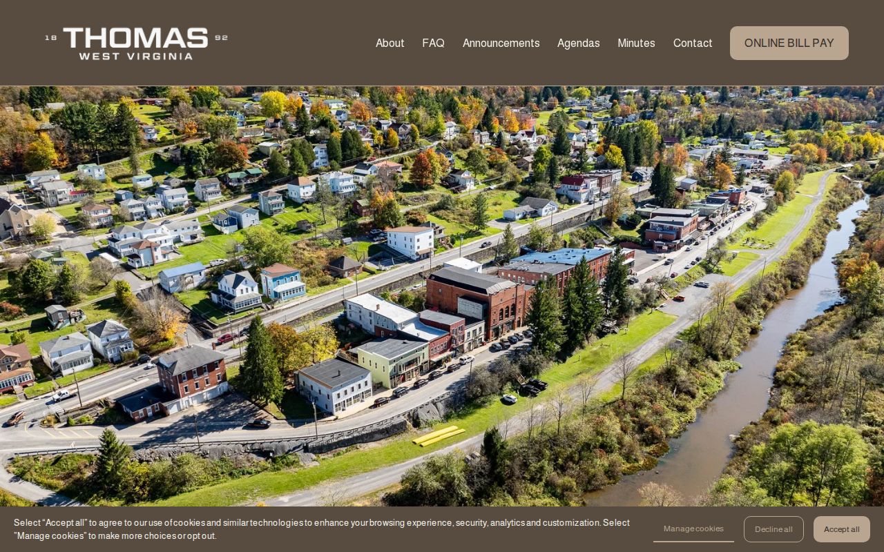
The city site image shows the municipal contact route for notices and permit questions.
Thomas Property Value Context
City sources publish no Thomas-only revaluation series or historic-district value study. For numbers, use the IAS Appraisal and Sales filters. There you can sort by date, price, land, building, total appraisal, acreage, and land use. Keep historic commercial parcels separate from residential Class II and municipal Class IV property. A homestead exemption also shapes taxable value.
The 1910 population figure and post-1956 industrial change describe how land was used, not what it sold for. Base any comparison on actual parcel fields and recorded sales. Skip any assumed coal-town-to-tourism price jump.
For commercial-district property, keep two ideas apart. The historic designation recognizes an area's past, while the assessor's land-use and class fields feed the tax record. Neither alone gives a current appraisal. Neither proves a storefront changed hands. Match the parcel number to the deed first, then weigh a sale against similar improvements and use.
Thomas Company Land Chains
Old Thomas property records can carry names tied to Davis Coal & Coke, railway holdings, or a private lot holder. A company name may surface as grantor or grantee. A street search alone can miss that history. Walk the recorded chain deed by deed, following conveyances, assignments, releases, and later private transfers. Record the book and page each time. Preserve the land description too.
Front Street architecture, Cottrill's Opera House, and industrial buildings help place an area in local history. They do not prove a parcel's footprint matches an older company tract. Use a plat or survey reference to connect them.
What Thomas Property Records Show
Thomas property records can document a county deed, an assessment value, tax status, a mapped surface parcel, or a city permit and notice. Each source covers one slice of the parcel story. A historical landmark is not a title record. An assessment is not a market appraisal. A map line is not a survey, so confirm the current land description with the source office.
Lawful use. Use Thomas property records for ownership research, house history, purchase diligence, and civic questions. Do not use a name or address to stalk, threaten, or harass anyone.