
How Tucker County Property Records Begin
A good search moves from location to proof. Start with the West Virginia Property Viewer when the only clue is a physical address. Its E-911 search locates the situs. The linked Integrated Assessment System, called IAS, can return a parcel from a street name, an owner, or parcel parts. Open the assessment report. It shows the legal description and the deed book and page when those appear. The Tucker County Clerk index confirms the instrument. A map, an assessment card, and a deed are related, but they are not the same record.
Already know the parcel? Its district, map, parcel, and sub-parcel values beat a broad name search. With only a name, start with the surname. Then test initials or business names. The county's online land-record page does not state its date range, image coverage, or search fields, so a gap in results is not proof that no deed exists. For a second route through the named portals, use the Tucker County property search walkthrough.
- Find the physical place in the WV Property Viewer, or search a street name in IAS if the address fails.
- Record the Tucker parcel ID, owner display, legal description, and any deed book/page reference.
- Check the clerk's deed index for the latest conveyance and any related releases or liens.
- Compare the assessment, tax, and map records by parcel ID and legal description.
- Ask the office that holds a missing record for an inspection or copy route and current fees.
Tucker County IAS Search Fields
The West Virginia Integrated Assessment System, or IAS, offers separate modes for basic searches and appraisal and sales. Advanced filters and prior ownership get their own modes too. For a Tucker County parcel, set the county selector first. Then match the field to the clue. Owner name accepts partial text. Street name often beats a full situs address. The local address field can be incomplete. Filling every box is unnecessary and can narrow the results too far.
| IAS field | What it narrows | Search note |
|---|---|---|
| Owner Name | Owner on the assessment roll | Try LASTNAME FIRSTNAME, then a shorter name |
| Street Name | Parcels along a road | Use the road name when a number fails |
| Full Parcel ID | One parcel key | Use the district, map, parcel, and suffix |
| Deed Book / Page | Assessment-linked deed reference | Carry it to the County Clerk index |
| Legal Description | Lot, tract, survey, or other text | Useful when an address is absent |
| Sale From / Through | Sale-date range | Available in Appraisal/Sales mode |
The full form goes further. It adds class and land-use selectors, acreage and appraisal ranges, building fields, a mailing address, a flood-hazard filter, and display controls for the legal description and GIS parcel ID. A field that does not appear in the rendered page is not a confirmed option. The IAS search form stays a free public route. The clerk can explain what the land-record index itself can search.
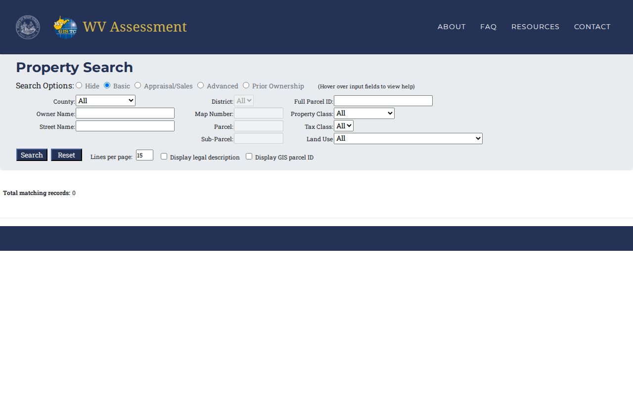
The official IAS form displays its separate search modes. Parcel, owner, street, and value fields are all available for a Tucker County lookup.
Tucker County Address Clues
The WV Property Viewer E-911 tool matches physical addresses in the statewide addressing system. It ignores rural routes and post office boxes. IAS keeps a separate property-address field. Those values can be incomplete. If a complete address returns nothing for a Tucker County property, enter the street name alone. Then narrow the candidates with the map and legal description.
Keep situs and mailing address separate. Situs is where the parcel sits. The owner's mail can go to another town, another county, or a post office box. A Davis, Thomas, Parsons, Hendricks, or Hambleton postal label is not a municipal boundary. Near a town edge, the county map's community layer, the tax class, and a recorded boundary exhibit give better evidence.
Tucker County Assessment Calendar
The Tucker County assessor maintains tax maps and public property records, lists exempt property, reviews homestead and disability claims, and studies sales each year. Land values are updated annually. Real estate is visited at least every three years. Property books go to the Board of Equalization and Review by February 1. Assessed values are certified by March 3. Those dates frame the assessment work, not a guaranteed day a deed appears in the public roll.
West Virginia assesses at 60 percent of market value. Appraised value times 0.60 gives assessed value. The levy rate then applies to that assessed value to calculate the tax. Class II generally covers owner-occupied homes and farms. Classes III and IV cover other property outside or inside a municipality. An appraisal is not the amount due, since assessment and levy fields belong to different steps.
Tucker County Property Records Offices
Four offices divide the main Tucker County property trail. The County Clerk records land instruments and probate matters. The Assessor keeps the public tax map and the value roll. The Sheriff serves as treasurer and tax collector. The Circuit Clerk holds circuit and family court files that may contain foreclosure, lien, partition, or title disputes. No combined search system joins them, so carry the parcel ID and legal description from one office to the next.
Tucker County Clerk
211 First Street, Suite 205
Parsons, WV 26287
304-478-2414 ext. 201
Tucker County Assessor
215 First Street, Suite 206
Parsons, WV
304-478-3727
Tucker County Sheriff
215 First Street
Parsons, WV 26287
304-478-2321
Tucker Circuit Clerk
211 First Street, Suite 407
Parsons, WV 26287
304-478-2606 ext. 202
Tucker County Deed and Court Trails
The Tucker County Clerk's land-record page covers deeds, deeds of trust, liens, and releases. It also covers assignments, agreements, affidavits, plats, and trustee reports of sale. Keep the instruments straight. A deed of trust secures a debt; it does not convey ownership. A release can clear a recorded lien. But match it to the original party and book/page before trusting it. Judgment and foreclosure disputes may also leave a case file with the Circuit Clerk.
For a foreclosure or boundary dispute, search the statewide Judiciary record-access route by party name. Then ask the Circuit Clerk for the public docket and copies. The Judiciary's court landing page does not expose its search fields in plain text. It also does not spell out its image rules. The two indexes answer different questions. A court file tracks pleadings and orders. A land index tracks the instruments recorded against property records for the parcel itself. Use both when a dispute touches Tucker County land.
Tucker County Parcel Map Layers
The WV Property Viewer is statewide. The assessor maintains the county surface tax map behind its parcel layer. For Tucker County, layers can add tax districts, address labels, delinquent properties, flood zones, contour lines, community boundaries, and USGS quadrangles. Streams and place names, highway routes, and survey marks can also appear. Zoom in before clicking. Viewer guidance suggests roughly 1:18,056 or closer for parcel identify, so shapes resolve first.
Point, Rectangle, and Polygon geometry searches plus Set Buffer Size can list nearby parcel candidates. The Viewer also accepts coordinates. Export results as CSV. Download a selected map as KMZ. Those tools preserve a search for later review. The map shows surface tax parcels only, never a survey, title opinion, or mineral-interest map. The WV Property Viewer gives Tucker County parcel context and its public map layers.
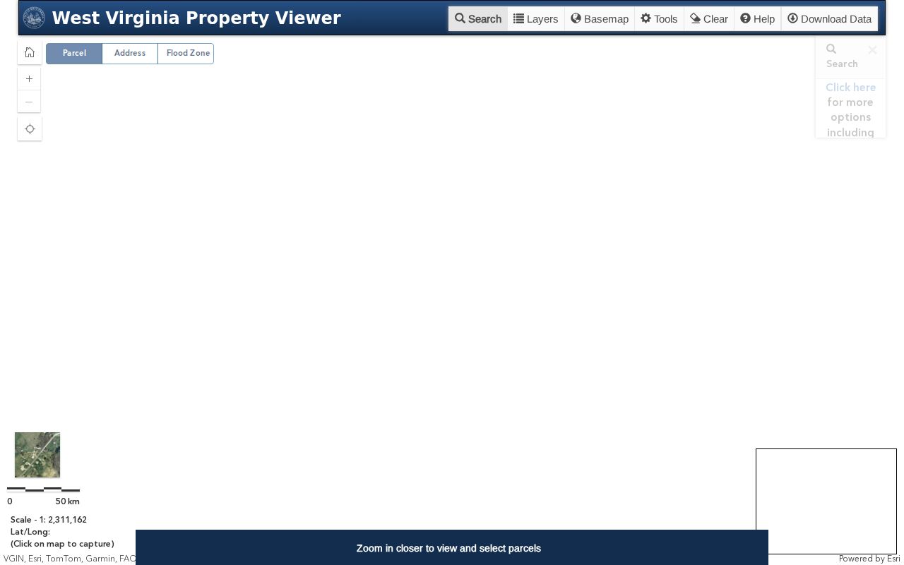
The map shell is just the starting view. The selected-parcel panel adds the detail fields you need to compare a map feature against an assessment record.
Parsons and Tucker County History
Tucker County formed in 1856 from Randolph County. A county-seat dispute later shifted records from St. George to Parsons. The West Virginia Encyclopedia dates the move to the night of August 1, 1893. The WVU collection shows photographs of a mob carrying records on August 2. Neither source says a courthouse fire destroyed land books. Treat both towns as historical search context. Do not infer a missing-record gap from the move alone.
The State Archives' Tucker bibliography points to county histories and newspaper clippings. It also covers accounts of the county-seat war. Five Rivers Public Library holds local genealogy material plus Parsons Advocate microfilm and CDs. Such sources can explain an old road, business, or family name. That name may turn up in a deed. Ownership still rests on recorded documents, though. The West Virginia Archives Tucker County finding aid lists the local history and microfilm leads. The bibliography also helps decode place names. Older parcel descriptions use these names in place of a current street address.
Tucker County Tax Sale Records
The Sheriff serves as county treasurer, tax collector, and keeper of tax records. Tucker County publishes no dedicated online tax-ticket lookup. For a current tax bill, payment, or redemption question, contact the Sheriff's Tax Office directly. The State Auditor runs a separate county-collections and sheriff tax-sale route for delinquent real estate. A tax-sale search never replaces a deed search. Nor does it prove a parcel remains available.
The Auditor cautions that parcels may be redeemed before a sale. Verify the current date, location, redemption, and payment status with the Sheriff and the Auditor. The statewide tax-sale file draws on county GIS and IAS surface-parcel data. That data can omit county court splits and mineral interests. Match the parcel ID and legal description before relying on any sale notice. The State Auditor county-collections search provides the statewide route for delinquent-land information; the Sheriff stays the local contact for tax status and collection questions.
Tucker County City Boundaries
Parsons, Thomas, and Davis each have a distinct municipal story. None keeps its own property recorder or assessor. Tucker County holds the deed and assessment trail for incorporated and unincorporated land alike. City offices add zoning, permits, ordinances, and boundary context. A parcel may be described as being in a town. Compare its legal description and community layer with the municipal record rather than trusting a postal label.
ZIP codes are delivery areas and may cross town limits. Local municipal sources list 26287 for Parsons, 26260 for Davis, and 26292 for Thomas. The official USPS boundary map is not published here. Parsons does offer an annexation or minor boundary-adjustment exhibit for land in Black Fork District. Some parcels sit in edge cases. The parcel's district, tax class, GIS community, and deed description work better than a ZIP.
The Assessor's tax classes reflect both use and location. Class II generally covers owner-occupied residences and qualifying farms. Class III applies to other property outside a municipality. Class IV applies to comparable property inside one. Rental or vacant parcels are often not owner-occupied. They can fall into a different class than a nearby home. A qualifying homestead exemption is a separate deduction from assessed value. It is not a change to the parcel boundary or the deed owner of record.
Types of Tucker County Property Records
Tucker County property records come in several forms. Land instruments, tax data, court files, and map layers each hold a different piece. A deed records a conveyance, while a deed of trust records a security interest against the land. The assessor's report describes the parcel for tax purposes. The Sheriff handles the tax bill and payment side. Court dockets show filed claims and orders. Matching everything by parcel number and legal description keeps all these sources tied to the same piece of Tucker County land.
| Record Type | What It Documents | Kept By | Access |
|---|---|---|---|
| Deeds and plats | Transfers, legal descriptions, recorded lot maps | Tucker County Clerk | Online landing page; ask clerk about index, images, and copies |
| Trusts, liens, releases | Secured debt, judgments, releases, trustee sales | County Clerk; Circuit Clerk for court filings | Land index and courthouse request |
| Assessment roll | Owner display, class, appraisal, acreage, sale fields | Tucker Assessor / WV IAS | Public statewide search |
| Tax bill and delinquency | Taxes due, collection, delinquent-land status | Sheriff; State Auditor | Counter or phone; Auditor online tools for tax sales |
| Parcel map | Surface parcel, community, address, flood and map layers | WV Property Viewer; county assessor maps | Free public map, CSV and KMZ controls |
Pick the right source for the question. The clerk's index answers who conveyed title and what was recorded. IAS holds the assessment value and parcel attributes. The Sheriff keeps the tax records. Tucker County offers no dedicated tax-ticket lookup online, though. The Auditor's statewide page covers delinquent-land sale information, not a current bill. For the full conveyance record, start with Tucker County deed records.
What Tucker County Records Prove
What can Tucker County public records actually prove? Each one covers a narrow slice. A recorded transfer, an assessed value, a tax status, a court filing, or a mapped surface parcel. A deed may be followed by a later instrument. An assessment card can lag behind a recent closing, and GIS lines are not survey work. Before any property decision, compare the latest deed, the legal description, the assessment report, and the tax record together.
Lawful use. Tucker County property records support ownership research, purchase diligence, tax review, and civic use. They are not a title opinion or survey, and using owner details to stalk, threaten, or harass someone is not a lawful purpose.